Airfield Information

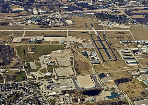
Runways
- 10/28 - 5,850 feet long, 100 feet wide, grooved concrete
- 18/36 - 3,599 feet long, 75 feet wide, asphalt
Control Tower
- Staffed daily from 6:00 a.m. – 9:00 p.m. by controllers from Midwest ATC Services Inc. – contact by phone at 262-650-0576
- Automatic Terminal information Service (ATIS) – available from 9:00 a.m. – 6:00 p.m.
- Automated Weather Observation System (AWOS) is operational 24/7 – Frequency 118.875. To access AWOS by phone, call 262-521-5226
Frequencies
- Tower - 123.7
- Ground - 121.6
- Milwaukee Approach/Departure - 125.35
- Clearance Delivery (When Tower is closed) - 128.7
- Automated Terminal Information Service (ATIS) – 118.875
- UNICOM - 122.95
- Common Traffic Advisory Frequency (CTAF) - 123.7
- Automated Weather Observation System (AWOS) frequency 118.875
Lighting
- Rotating Beacon dusk to dawn, and during IFR conditions
- Airfield lighting sunrise to sunset
- Precision Approach Path Indicators (PAPIs) on Runways 10, 18, and 36
- Visual Approach Slope Indicators (VASI's) on Runway 28
- Airfield lighting pilot controlled during non-tower operations, 9:00 pm to 6:00 am. Low intensity 3 clicks in 5 seconds; medium intensity 5 clicks in 5 seconds; high intensity 7 clicks in 5 seconds
- MALSR (Medium Intensity Approach Lighting System with Runway End Identifier Lights) RWY 10
Elevation
911 feet Mean Sea Level (MSL)
1,911 feet MSL pattern altitude, all aircraft
Approaches
ILS or Localizer RWY 10
RNAV (GPS) RWY 10
RNAV (GPS) RWY 28
VOR-A
Security
Full perimeter fence with barbed wire
Security gates with access control
At the Airport
Quick Links
